
Agricultural & Ranch Lands Areas of Interest (EEMS) - Santa Barbara County
Jun 21, 2017
Created by
SB Atlas Admin

- Description
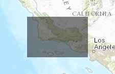
- This map shows aggregated data layers using the Environmental Evaluation Modeling System (EEMS). It also has preloaded all of the input data layers.
- Location
- Credits
- SB Blueprint Team
- Use Constraints
 This work is licensed under a Creative Commons Attribution 3.0 License.
This map is visible to everyone
Bookmarked by
2 Groups
About the Map Author
SB Atlas Admin
Admin Account with Santa Barbara County Conservation Blueprint
The purpose of the Blueprint is to provide a public data platform and common language to support in depth conversations and decisions about our shared aspirations. This collaborative project aims to describe the current landscape, natural resources, and community values about land in Santa Barbara...