
Lands with Multiple Benefits

Explore related items…
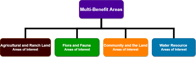
Lands with Benefit to Water Resources, Flora and Fauna, Ag and Ranching, and Community and Recreation.
Found throughout the Conservation Blueprint Report and the Atlas are areas of interest maps for each theme:
- Water Resources Areas of Interest
- Flora and Fauna Areas of Interest
- Agricultural and Ranch Lands Areas of Interest
- Community and the Land Areas of Interest
Each of these maps were created by synthesizing and integrating relevant thematic data among the hundreds of individual data sets within the Atlas in order to:
- Help clarify and communicate the conservation trends and challenges in the County and
- Assist with the development of strategies to support a landscape of opportunity
In order to synthesize the relevant data layers for each theme the Blueprint used the Environmental Evaluation Modeling System (EEMS), a tool that combines multiple layers of spatial data into useful synthesis maps. This method incorporates community objectives for this project, including transparency of data sources, creating maps that are descriptive and not prescriptive, and using science and community expert input. These maps compare different types of data in a logical and transparent way (i.e. users can “look under the hood” to see how the data were processed using the EEMS Explorer). Additionally all data were compared on the same scale from 0-1 and combined by adding them together using map algebra. See Appendix C in the report available here for more information about map algebra methodology.
While EEMS was used to create a synthesis map for each theme highlighting areas and concentrations of resources for water, flora and fauna, agriculture and ranch lands, and community and the land, a new question arose:
- Where on the landscape are there concentrations of all the themes?
In order to answer this question a new synthesis map was produced combining the areas of interest outputs for each theme into one map. This map is called the Multi-Benefit Areas map and can be found in the "Explore related items…" section of this page.
This Multi-Benefit map offers a quick snapshot of overlapping areas of interest for two or more of the four Blueprint themes. This Multi-Benefit Map together with the additional topical maps and synthesis maps featured throughout the Atlas, are meant to support meaningful visual insights about resources in the Santa Barbara County landscape, and to stimulate conversations about key issues. The Multi-Benefit areas identified show places in the County rich in natural resources and of likely interest to the community.
Note that this multi-benefit areas map does not map out conservation priorities - this would require more robust and complex community input and analyses to navigate the uncertainties and decision-points in defining priority areas for conservation.
Below is a video about how to find and navigate the EEMS Explorer for the Multi-Benefit maps:

If you have any questions about this map or about how you can use EEMS for your own organization or conservation priority please email info@sbcblueprint.net.
- Citation
- SB Atlas Admin. 2017. Lands with Multiple Benefits. In: Data Basin. [First published in Data Basin on Jun 22, 2017; Last Modified on Oct 26, 2021; Retrieved on Apr 26, 2024] <https://databasin.org/articles/2d84c23b3dfb4912b073353cbec576db/>
About the Author
The purpose of the Blueprint is to provide a public data platform and common language to support in depth conversations and decisions about our shared aspirations. This collaborative project aims to describe the current landscape, natural resources, and community values about land in Santa Barbara...